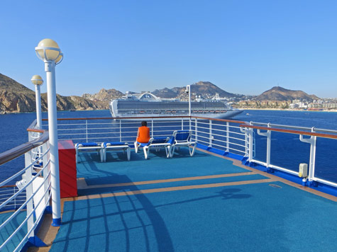
Cabo San Lucas, Mexico
Guide to Cruise Ports and Terminals
Cabo San Lucas is a city of 60,000 people located on the Mexican Riviera at the tip of the Baja California Peninsula. It is a popular port-of-call for cruise ship passengers and a party destinations for others.
All cruise ships visiting Cabo San Lucas must anchor offshore. Passengers are then tendered to the Tender Pier at Cabo Marina. A beautiful pedestrian pathway runs from the pier right around the harbor.
Because cruise passengers are tendered directly to the marina in Cabo San Lucas, a port shuttle is not needed.
Local buses connect Cabo San Lucas to San Jose del Cabo and the beaches and resorts in the "Tourist Corridor". Buses depart every 15 minutes. Fares are USD $2.50 each way.

Top tourist attraction in Cabo San Lucas include the following:
Things to do in Cabo:
View map of Cabo San Lucas Cruise Port. Note: Passengers must tender to Cabo Marina.
The currency used in Mexico is the Mexican peso.
Cabo San Lucas enjoy a warm and arid climate year-round. The town enjoys 350 days of sunshine each year. The best time of year to visit is from December to February, when maximum temperatures are below 30 degrees celcius.
Average daily temperatures by month are as follows:
| Month | Minimum | Maximum | Precipitation |
|---|---|---|---|
| Jan | 12 | 26 | 3 mm |
| Feb | 12 | 29 | 5 mm |
| Mar | 13 | 30 | 7 mm |
| April | 15 | 33 | 4 mm |
| May | 17 | 35 | 8mm |
| June | 21 | 37 | 107 mm |
| July | 24 | 37 | 107 mm |
| Aug | 24 | 37 | 75 mm |
| Sept | 23 | 36 | 65 mm |
| Oct | 21 | 35 | 43 mm |
| Nov | 16 | 32 | 8 mm |
| Dec | 13 | 28 | 6 mm |
Wi-Fi access is available at many restaurants and cafes in Cabo San Lucas Mexico including Starbucks, Cabo Coffee Company and Cafe Cabo.